What Was That Helicopter Over Palm Springs?
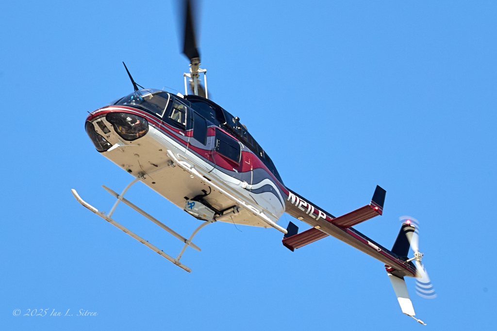
That helicopter flying low and in straight lines over Palm Springs last Saturday? It wasn’t spying, spraying, or part of a secret mission. It was N121LP, a Bell 206L-4 LongRanger equipped with a stabilized aerial survey system—likely LiDAR or high-resolution photogrammetry. These kinds of flights are routine for mapping terrain, inspecting infrastructure, or documenting utility corridors.
Plenty of curiosity (and a few conspiracy theories) circulated, but it’s just data collection from above. I photographed it while it worked its grid over the city. But where are those Chemtrails!
Aerial Survey Over Palm Springs: Bell 206-L4 with Sharper Shape Imaging System
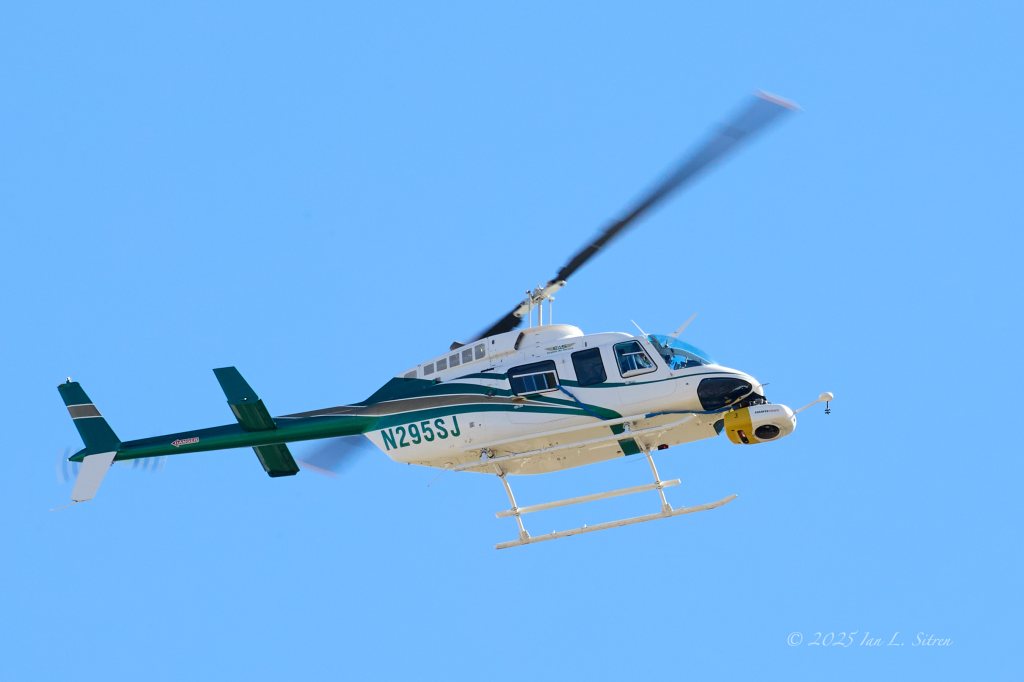
On Saturday, many people in Palm Springs noticed a Bell 206-L4 helicopter circling the area. I took the opportunity to photograph the aircraft mid-flight and identified it as N295SJ, a privately owned helicopter equipped with a Sharper Shape Heliscope 2.0—a specialized aerial imaging system used for infrastructure inspections, power line surveys, and vegetation management.
This particular helicopter is owned by Premier Rotors LLC, a company known for providing aerial services for utility companies, infrastructure monitoring, and environmental assessments. The presence of the Heliscope 2.0 system suggests that the flight was part of a detailed survey, likely scanning power lines, roads, or other infrastructure components that require regular maintenance checks from above.
Aerial surveys like these play an essential role in detecting potential hazards, identifying vegetation encroachment, and ensuring infrastructure integrity, helping companies and local governments maintain large-scale networks efficiently. These flights are common across urban and rural landscapes, providing critical data that would be difficult to gather from the ground.
If you spotted this helicopter in the skies over Palm Springs, now you know what was happening.
